On January 1, 2017 started Van Ons Lab: an initiative to make cool concepts accessible to a wide audience. The first prototype of this year has been launched: FeedMap.
For some companies, governments or public institutions it is important to collect input about places or physical locations. You want to know something from people about that one specific location. In short, you collect information that always has something to do with a certain place, a dot on a map.
The reality is that collecting this kind of data is not easy. Because how are you going to remember what 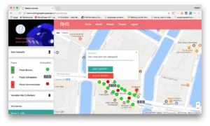
What you need is a tool that allows a group of stakeholders to indicate what they want and where. You also want to know exactly what they want and where. Think of trees, zebra crossings, traffic lights or parking spaces. And whether they have any additional comments or not.
With FeedMap you can solve this problem in four simple steps:
With FeedMap you can use maps for the locations, but you can also work with images. This also makes FeedMap interesting for retailers, for example, who want to research the ideal shelf layout, store design or product presentations.
It works as follows:
- Define the area that you want to visualize for users and which elements they should put on the map (for example trees, waste bins, zebra crossings, traffic lights, or whatever);
- Invite users to join and open the map;
- Users place elements on the map, providing comments on elements that you as an administrator have prepared;
- View and compare the submitted results!
Also check out the solutions page for screenshots of these steps!
Want to know more or test with FeedMap?
Would you like to know more about FeedMap or perhaps already get started with it? Check out our brochure on SlideShare and download it as a PDF. Call 020 331 81 77, ask for Robert van Eekhout and discuss with him the possibilities of FeedMap for your case!